GR4 Recce weekend - A Grand Day Out, plus Khyber Pass news and cross country Victoria to Gold River
- Jonathan Binnington
- Oct 30, 2023
- 5 min read

A steamy DR650 cold start at -4C...
Saturday 28 October saw the latest GoldRiver400 route reconnaissance expedition. The area of interest centred on Sayward Junction with the ambition to investigate the suitability of a number of routes and roads new to the GoldRiver event.
The weather the weekend before had been wild, wet and windy, followed by five days of quiet, clear but very cold autumn days. Contradictory road conditions reports meant we (myself, Randy Leonard of the Cedar Motorcycle Training School in Nanaimo and his tow Instructors, Kelly and Kevin) set out on our weekend not knowing exactly what we would find...
There were three lots of new route candidates to look at to see if they would be suitable for inclusion in next year's event.
To give an advance summary of this report, two of the roads are blocked by wind-felled trees and are likely to remain so, one of the sets of roads offers the possibility of a complete route from Victoria to Gold River that bypasses Highway 1 and 19 from Victoria/Malahat to the Highway 4/19 junction and then a backcountry route from Campbell River to GoldRiver and the third set of roads are highly likely candidates for inclusion in next year's event.
Of course I'm not going to tell you exactly which roads they are, but I'll be much more explicit about the others!
The Conditions.
The rain of the previous weekend's "atmospheric river" had fallen as snow over the higher ground on Vancouver Island and the subsequent sunny days and frosty nights guaranteed a mix of road conditions - dry and hard dirt roads, iced sections, crunchy snow sections and eventually ankle deep squeaky-cold snow that had been passed by a 4wd vehicle but wasn't for us...

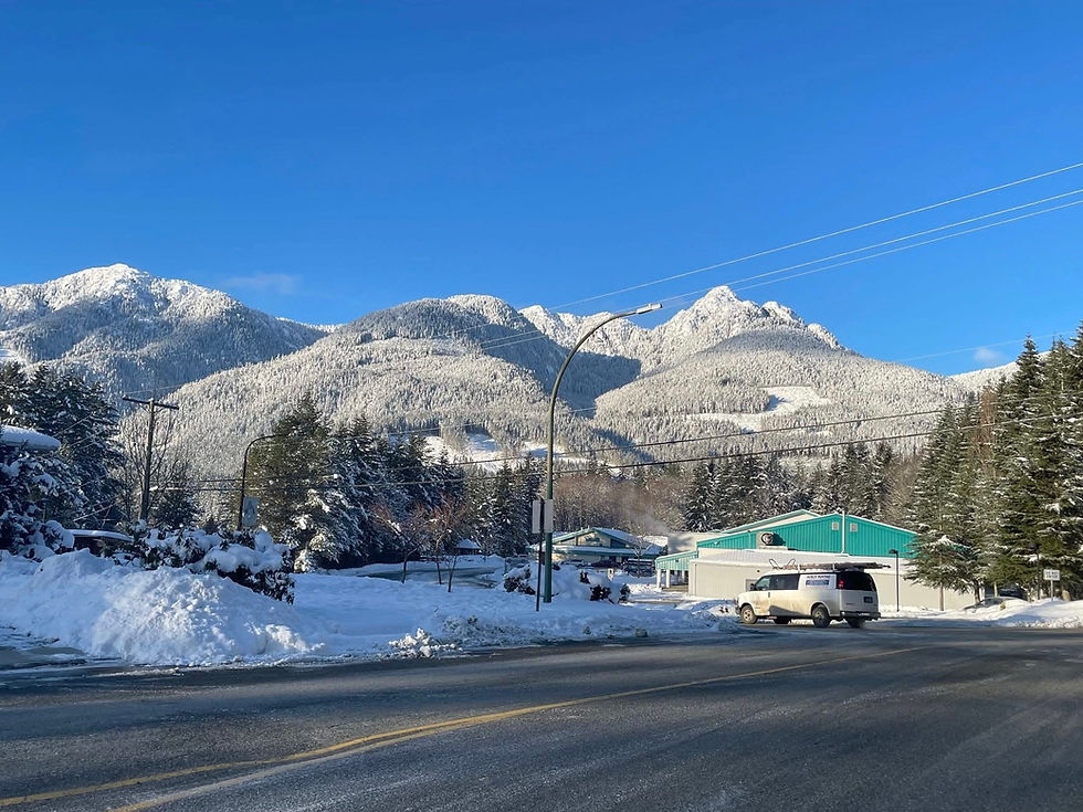
Up to about 350m/1000ft, all the roads regardless of their aspect were clear and dry. Between 350m and about 700m (the highest we were able to get) the conditions depended entirely on the aspect of the geography. South-facing, sun exposed were dry and very firm. In contrast, north-facing valley roads, hidden from the afternoon sun remained snowed up.


This was as far as we got!

Obviously a 4wd vehicle has managed to pass, but not us!
The Morning...
One of the North Island 1000 routes from Campbell River follows the now decommissioned Menzies Main from west of Brewster Lake to White River Main.
The ideal situation would be a loaded adventure bike-friendly backcountry route from Campbell River to Gold River. Menzies Main used to offer such a route until a creek crossing was disabled in a fairly significant way leaving 15metre deep by 25metre wide canyon in very friable soil as the crux section in the route that has been (mostly) reopened by the good NI1000 people and renamed the Khyber Pass.
The Khyber Pass crux is passable by ATVs in 4wd with locked diffs but isn't a practical proposition for motorcycles. I know, I have been there. I have tried.... Besides which, the further part of Menzies Main between The Big Ditch and Stuart Main is still blocked by trees that were blown down two winters ago.
CORRECTION: The North Island 1000 people cleared the remaining downed trees over the same weekend we were out. The Khyber Pass route is now open but passable with difficulty due to the snow, deep washouts and general overgrownness. They describe it as a "double black diamond". Not a casual undertaking - take a saw and a crew to haul you out!
I have looked at the maps and seen an alternative route and wondered about an alternative.....

On this image, Sayward Junction is top left, Campbell River is bottom right, Hwy19 runs diagonally between them across the top. While the road between SJ and CR is a good road, often with little traffic on it, from the perspective of a backcountry motorcycle traveller it isn't very interesting.....
Menzies Main/Khyber Pass (off the bottom of this picture) is out - but what about the other collateral routes? At this point you will need to trace these roads on your copy of Gaia.
Initially we looked at the hookup between White River Main and C Branch FSR, shown above as the short red road top left. Less than 1km in it was blocked by blown-down trees and without tools, time or inclination we turned around.

We didn't walk up it to see how far the blockage continued and as the road is obviously not important to the forest industry operations, this road will remain closed for a while yet...

Turned around, we backtracked up White River Rd, giving way to log-hauling trucks to Salmon River Main heading east to the C Branch Main FSR heading south. Through increasingly wintry conditions, we persisted our way up the Middle Memekay River valley to the point where C Branch crosses the Middle Memekay and becomes the Middle Memekay West Main...

This was as far as we were prepared to try to go! There were 4wd tracks leading off through the snow, it appeared there was only one set of tracks, it seemed likely that someone had driven through that way and therefore Middle Memekay West Main joins up with something and heads east - to Campbell River....
The best overland backcountry route from CR to White River Main will have to wait now until the spring thaw.
The afternoon....
We backtracked again to Sayward Junction for fuel and food before tackling the next set of routes. I'm going to be a little coy about exactly where we went now because these roads are highly likely to be incorporated into the GR4 event routes. I don't want to spoil anyone's pleasure, but I will go so far as to say we spent the afternoon around Tlowils Lake.
Again, the first road we tried was blocked by a fallen tree. Given we can't go that way, I'll show you where it is!:

There are enough clues on this map for you to work out where the fallen tree (in the black triangle) actually is. Sayward Junction is middle right off this image.
We turned around again and spent the next hour and a half slithering around on north-facing frozen roads - but the roads are open. Not much exciting to report other than the slippery stuff made the going difficult, then, as the afternoon was wearing onwards and temperatures were dropping once again, a flash of inspiration suggested two, south-facing routes in the vicinity of Newcastle Ridge...
In the strong afternoon direct sunshine they were dry, free of snow and ice and deliciously steep! These are keepers! If you enjoy traveling the backcountry, climbing mountains from the seat of a bike you will love these roads. No more clues but I will say the route off is a descent that is just as interesting as the climbs...
The evening...
Back to the Elk Creek Recreation campsite at Sayward Junction for Steaks and Potatoes (c/o Randy) cooked over the largest fire we could build, a very cold night sleeping in the car and a bacon and egg breakfast c/o Katrina before driving home to a warm comfortable bed.
160, dry and mostly sub-zero kilometres. No one hurt or lost. No bikes broken. The objectives of the day had been fully met in the company of perfect gentlemen. We will do this again, but probably not until the spring.
If anyone can fill me in on the backcountry routes between Campbell River and C Branch FSR/White River Main, I would very much appreciate hearing from you.
Best Wishes
Jonathan


Comments