Navigation, methods, technology and techniques, part 1. Tablets and Apps…
- Jonathan Binnington
- Jan 7, 2022
- 6 min read
So, you are considering entering the GoldRiver200 rallyraid but are unsure about how to “do” the navigation thing? This is the first in a series of articles that are intended to take the most tech-unsavvy individual up to a level of basic competence with both the hardware (iPhones, iPads, smartphones, tablets, mounts and charging systems) and the software (mapping apps) downloadable onto the hardware devices and used either with cell phone signal or downloaded over WiFi connections into the device’s memory and run in a stand-alone manner using the phone’s GPS sensors. Then, take the user into the world of routebooks, routebook symbols and conventions and finally a look at some of the different ways routebooks can be displayed and read while “on the move”.
It is not my intention to give a high level discussion about the detailed technology, nor will I be giving specific instructions on how to work any system in detail. This level of detail will not enhance everyday use of these systems, if you are already at this level there isn’t anything I could say to advance your knowledge and you are already well-aware of where to find this information should you want it. In this first part of a three part series I will walk you through how to get 21st Centrury navigation reliably and affordably onto your bike. Part 2 will look at routebook navigation, how it can be displayed on your bike and an attempt to dispel some of the magic and mystery surrounding the hieroglyphs (cartoglyphs?) used to describe routes.
Part 3 will look at the newest electronic technology developments on offer to those wishing to participate in high-end rally and adventure raid motosports and how this technology can be used by ”weekend warrior” enthusiasts and organisers of events aimed at this group of riders. A short discussion about satellite SOS calling and communication devices will also be included to complete a round-up of matters-tech.
Paper maps to their current electronic equivalents.
Perhaps the last time you had to find your way through the backcountry was when you were in the Scouts or Guides? Everything was done with a large paper map and compass?
Everything you knew then has gone somewhat hazy?
Since then you have come to rely on the various GPS (satellite navigation) systems you have on your phone, in the car and on your iPad?
Or maybe you have already worked out how to use smartphone navigation apps, running GPS on downloaded maps and you want to try your hand at “roadbook” navigation as an introduction to motorcycle Rallyraid motorsport as part of a progression towards expert-level involvement with Rallyraid (technical single track routes) and Adventure-raid (less technical routes over long distances on large capacity heavyweight off-road bikes)?
You are wondering about which technology you want to buy into, paper scroll printed routebooks, smartphone/tablet PDF systems or the newest tech-based systems that combine GPS mapping technology, PDF displays and recording technology that makes a real-time record of the participant’s progress around a course, their speeds and calculates penalties. An example of this technology is the Rally Comp system https://rallycomp.weebly.com/
So, where to start?
The good (or bad, depending on your viewpoint) thing is that all the conventional, traditional paper cartographic methods and presentations are replicated by the mapping apps. If you are familiar with the graphical representations of roads, rivers, bodies of water, contour lines, heights, the cardinal compass points. Your knowledge of what things mean on a paper map transfers to the app maps. You will find powerful added functionality that is impossible to create on paper. Pinch-and-spread to zoom in and out, recording to keep a track of where you have been and your speeds over the ground, predictive route finding.
The mapping app for the GoldRiver200 event will be Gaia. I have used a few other apps but the one I like the most is Gaia. The basic version is free to download, it runs on cell-phone signal in free mode and has full app functionality - provided you stay in cell-service range.
If you want to go out of cell-service range and still want to use maps you need to buy the app upgrade. It is about 50$ for a year and the upgrade enables the app to download the map for a given area and store it in your smartphone memory. Then, when you are out of cell-range you run the stored map and use the GPS functionality in your phone to keep track of your position on the map.
Gaia is available from the App Store on your iPhone and wherever else you download apps from…. https://www.gaiagps.com/
In the Apple App Store, Gaia looks like this:

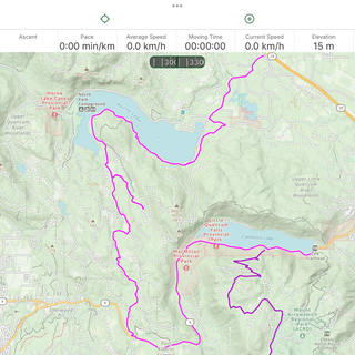
As a demonstration, I have added some screenshots of a ride I did last summer, progressively zooming in on the route that I took and Gaia recorded. You will see in the second picture I needed to circle a few times at one spot in order to sort something out. If you are wondering, this route is around Horne Lake and Cameron Lake, Port Alberni and nowhere near Gold River….
Which device to run Gaia on?
Without doubt, new smartphones are expensive. They are especially expensive if you consider the chances of dropping them I’m a puddle and having someone run them over out in the woods is a good probable. So what are the less expensive alternatives and what are the desirable features of a smartphone intended for Navigation purposes?
To take the last of these questions first, the desirable features of your smartphone are: GPS receiver capability, fast computing speed, large internal memory and long battery life.
To my knowledge all smartphones made in the last five years come with GPS receivers. Some conspiracy theorists don’t like the fact that there is a “hidden functionality” in their phones that means they can be tracked… For our purposes, this functionality is exactly what we need!
Computational speed. I don’t know how many calculations per second a mapping app needs to do when you are tracking your movement while zooming in or out of a map area while getting the app to plot you a route but, I have tried running Gaia on a very old phone and the response of the app is anything but real-time. A reasonably recent smartphone is therefore high up on the list of desirable features.
Similarly, a reasonably large internal memory is required to hold all of the mapping data the app calls for. There is a work-around for this that I will reveal in a line or two, along with a solution to issues of battery life.
Rather than buying a new smartphone or using your existing and recently bought smartphone and running the risk of having it befall a catastrophe, falling into a puddle and being run over by a hairy fat (fairy hat?) bloke on a Husqvarna or a Husaberg, a cost effective alternative is to buy a secondhand smartphone, minus it’s SIM card and cell phone account, from any of the usual places secondhand items are bought and sold.
A reasonably recent secondhand iPhone can be bought for a couple of hundred dollars. You don’t need the SIM card as you will be using it as a mini-iPad rather than a phone. If the previous owner hasn’t wiped the data previously stored on the phone, you as a ethical secondhand purchaser should do that in front of the seller as you do not want to be accused of any type of data theft in the future. Instructions for wiping an iPhone can be found here: https://support.apple.com/en-ca/guide/iphone/iph7a2a9399b/ios
Having bought the phone, removed and returned the SIM card and wiped the data store on the phone you are now able to load fresh apps for your purposes using WiFi download.
Wiping the previous data contents on your new old iPhone frees up a good quantity of internal memory and extends the time the phone will run on a battery charge as does turning Bluetooth off.
Load Gaia and once you have opened it, subscribe to the Premium upgrade that allows you to download maps by WiFi and store them on your ”navigation” phone, you run them offline. There are tutorials in the app to help you quickly get the hang of using it to plan routes, share with others, follow routes and track your progress while on the move.
You will need to run the phone continuously while you are out and even a new phone probably won’t have sufficient battery life for a full day of “on”. You can work around this limitation by wiring into your bike’s electrical system what used to be called a “cigarette lighter socket”, buying a charger insert and running the phone with the charger connected. This way you can get a full day of on-use without having the phone die on you.
The next piece of your jigsaw puzzle is where to put the phone for easy viewing and safe storage while traveling.
The easiest answer to this is probably in a tank-bag with a transparent lid. This solution will also keep rain and mud off the phone - provided the shape of your fuel tank allows a tank bag to be strapped to it.
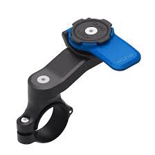
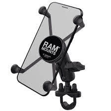
There are many different types of handlebar mounts available now, each differing slightly in the way it attaches to the phone and the handlebar, the space it needs and it’s effectiveness - no, I don’t have a recommendation…
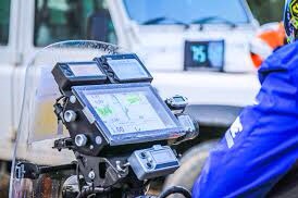
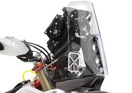
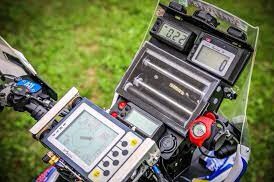
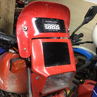
Finally you can build or buy some type of frame or handlebar mounted “device tower” - replicating the navigation towers the Pros use - or even make your own… but that may be getting beyond the cost or complexity a new entrant to this form of motosport wishes to begin with.
Further reading in anticipation of the next stunning episode….. https://rustsports.com/rally-raid-an-idiots-guide/
Next time, routebooks, symbols, paper/pdf, readers and how to use a routebook compared to using a Gaia map track.
jdb 7/1/22


